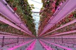
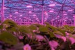
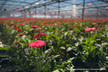
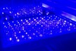
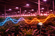
A new map shows how much light pollution there is after entering a postcode. This is an experiment by KRO-NCRV. The postcode tool contains 11 million 3D buildings. According to the makers, light pollution in the Netherlands is most intense in Westland, with many greenhouses. Large cities such as Rotterdam and Amsterdam also stand out on the map.
Click here to see how the greenhouses light up the Westland area
Source: KRO-NCRV